Will your boat clear the canal at low tide, or will you be waiting for the water to rise before you head out? If you’re eyeing a waterfront home in Hernando Beach, that question matters for your daily routine and your long-term value. You want smooth, safe access to the Gulf and a property that holds strong appeal when it’s time to resell. In this guide, you’ll learn what “tidal access” really means, how to evaluate it, and the practical steps to protect your purchase. Let’s dive in.
What tidal access means
Tidal access describes how easily you can get from a dock or canal to open water at different tide levels. In Hernando Beach, that comes down to three things: water depth at low tide, bridge and utility clearances, and local no-wake rules. These factors shape your launch timing, your route, and even your boat type.
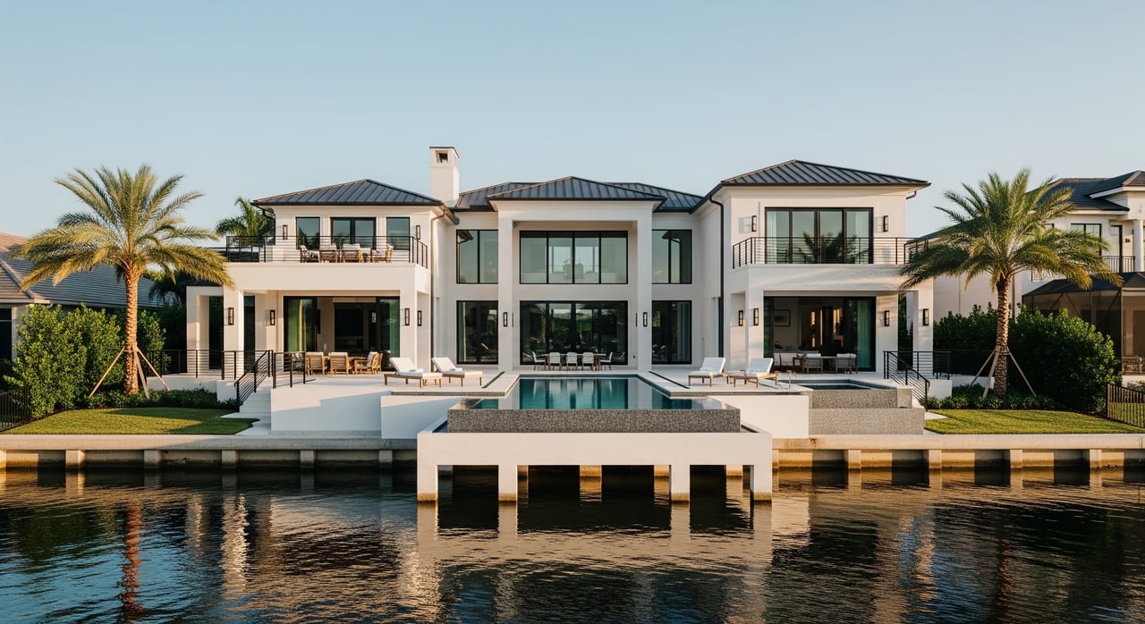
Reliable access is a lifestyle win. Uncertain access creates stress and limits how often you can enjoy the water. It also influences demand, which can shape resale value.
Tides and depths to check
Read local tide tables
Your baseline is the local tide prediction. Use the nearest NOAA station to Hernando Beach and compare times and heights over several days. When you check depth, use the same datum NOAA uses for charts, typically Mean Lower Low Water (MLLW), so your comparisons are apples-to-apples. You can review nearby tide stations and predictions on NOAA Tides & Currents.
Verify canal and channel depth
Charted depths show what surveyors recorded, but shoaling can change things. Start with the official soundings on NOAA Nautical Charts, then ask for the most recent surveys or dredging updates. The U.S. Army Corps of Engineers’ Jacksonville District shares navigation notices and survey work that can signal changes in maintained channels; check the USACE Jacksonville District for updates.
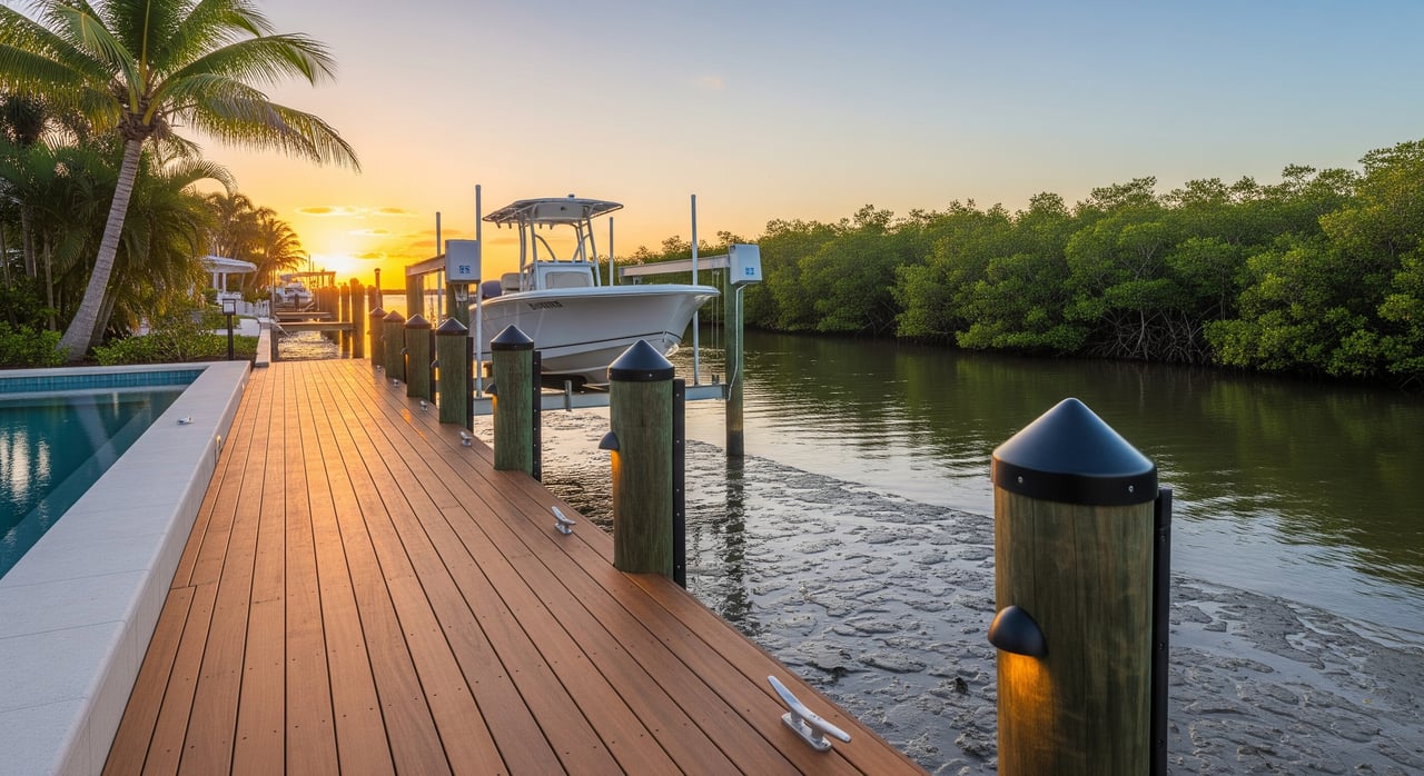
When you tour a property, visit at or near low tide. Look at water alongside the dock and along the route to a maintained channel. For most powerboats, a practical rule is your boat’s draft plus a safety margin of at least 1 to 2 feet at low tide. Larger or heavier boats may need more margin.
Bridge and utility clearance
Find posted clearances
If your route passes under any fixed bridges or utilities, confirm the vertical clearance and the water level those numbers reference. Many clearances are posted relative to Mean High Water. You can find clearances and notes on NOAA Nautical Charts and verify any temporary changes through local authorities or U.S. Coast Guard notices.
Do the air draft math
Measure your boat’s highest fixed point, such as a hardtop, mast, or radar arch. Compare that air draft against the posted clearance for the tide stage when you plan to pass. Remember that higher tides reduce effective clearance. Always allow a comfortable buffer.
Currents, wind, and shoaling
Tidal currents and seasonal wind patterns can affect how you enter or exit channels, especially near inlets. After storms or during dry spells, shoaling may shift in certain locations. Balance charts with on-the-water observations, and ask local marina staff or captains about any recent problem spots.
No-wake rules and timing
Where to confirm rules
Idle-speed and no-wake zones slow your trip and add time to each run. These zones can be posted near docks, marinas, and sensitive environmental areas. Review state guidance through the Florida Fish and Wildlife Conservation Commission, and check local postings and maps through Hernando County. Knowing the route and restrictions helps you estimate realistic travel times to the Gulf.
Buyer due diligence checklist
Use this list to protect your purchase and your boating plans:
Paperwork and disclosures
- Request recent dock or marine inspections, any available channel surveys, and dredging history.
- Ask for copies of dock and boatlift permits, plus any HOA rules or easements tied to water access.
- Confirm whether special assessments for dredging or dock repairs exist or are expected.
Site visits and measurements
- Visit at low tide to observe depth at the dock and along the route to a maintained channel.
- Measure your boat’s draft and add a safety margin for low-tide clearance.
- Measure your boat’s air draft and compare with posted bridge or utility clearances, noting the water level reference.
- Ask local marina staff about recent shoaling and typical low-tide depths.
Rules and permitting
- Verify that existing structures comply with county and state rules via Hernando County resources.
- If you plan upgrades, check likely environmental constraints. The Tampa Bay Estuary Program can help you understand regional environmental context that may impact permits.
Safety and insurance
- Review flood zone and windstorm exposure with your insurer.
- Ask whether channel conditions or access history affect marine insurance.
Professional support
- Hire a marine surveyor or local captain to test-run the route at low tide.
- Get estimates from a marine contractor for any dock repairs or lift changes.
- Ask a real estate attorney to review title, easements, and any channel maintenance agreements.
Lifestyle and resale value
Reliable tidal access equals more spontaneous boating and less clock-watching. If you can safely leave and return at most tide levels, you will boat more often and with less stress. If your route depends on higher tides or a tight bridge clearance, you will plan trips more carefully.
From a market standpoint, properties with documented, year-round navigable access tend to attract a wider buyer pool. Factors that can narrow demand include shallow canals at low tide, low bridge clearances that limit popular boat types, unpermitted or aging docks, and long no-wake stretches that add significant transit time. Properties backed by recent surveys, proper permits, and clear maintenance responsibilities typically show stronger buyer confidence.
How to verify the numbers
- Tides and heights: Check the nearest prediction station on NOAA Tides & Currents.
- Depths and clearances: Confirm soundings and vertical clearance notes on NOAA Nautical Charts.
- Dredging and surveys: Look for current notices on the USACE Jacksonville District.
- Local rules and postings: Review state boating guidance via Florida Fish and Wildlife Conservation Commission and county resources through Hernando County.
- Environmental context: Explore regional constraints through the Tampa Bay Estuary Program.
How JT Realty helps
You deserve clear answers before you buy on the water. Our team arranges boat-access showings so you can experience the route at real tide conditions. We coordinate permit and survey document requests, connect you with marine pros for depth checks, and align your home search with your boat’s needs. If you want a smoother path to closing, we also integrate mortgage pre-approval so you can move fast when the right property hits the market.
Your next steps
- Shortlist properties that match your boat size and style.
- Pull tide predictions for your showing days and plan at least one low-tide visit.
- Review NOAA charts for routes, depths, and clearances, then confirm with on-site observations.
- Ask for permits, surveys, and any dredging or maintenance history in writing.
- Bring in a marine surveyor or captain for a low-tide test run if you are serious about an offer.
If you want a confident, practical plan tailored to Hernando Beach, we’re ready to help. Reach out to JT Realty & Associates to line up boat showings, document checks, and a clear strategy from offer to close.
FAQs
What does “tidal access” mean for a Hernando Beach home?
- It describes how easily you can reach the Gulf from a property across different tide levels, considering low-tide depth, bridge or utility clearances, and any no-wake zones along your route.
How do I use NOAA tide tables when evaluating a dock?
- Look up nearby predictions on NOAA Tides & Currents, note low-tide times and heights, and compare your boat’s draft plus a safety margin against observed depth at the dock and along the route.
Where can I confirm no-wake or idle-speed zones near Hernando Beach?
- Check statewide guidance via the Florida Fish and Wildlife Conservation Commission and review local postings through Hernando County before you estimate travel times to the Gulf.
How do bridge clearances affect my boat choice?
- Measure your boat’s air draft and compare it to posted clearances on NOAA Nautical Charts, noting the water level reference; a low fixed bridge may limit tall center consoles or boats with towers.
Who maintains channels and handles dredging in this area?
- Responsibilities vary by route and community; look for notices on the USACE Jacksonville District and ask sellers or HOAs for maintenance agreements and dredging history in writing.